

Australian Government Bureau of Meteorology, Queensland
Minor Flood Warning For Warrill Creek And Final Flood Warning For The Bremer River
Issued at 10:47 AM EST on Friday 04 April 2025
Flood Warning Number: 6
MINOR FLOODING CONTINUES AT AMBERLEY
The main flood peak along the Warrill Creek has now passed Amberley, where minor flooding continues to slowly ease.
River levels are falling and flooding has now eased along the Bremer River.
A chance of showers is forecast for the remainder of Friday into Saturday. However rainfall totals are not expected to be significant and no further significant river level rises are expected.
Warrill Creek:
Minor flooding is occurring along the Warrill Creek.
The Warrill Creek at Harrisville is currently at 2.30 metres and falling, below the minor flood level (3.00 metres).
The Warrill Creek at Harrisville is expected to remain below the minor flood level (3.00 m).
The Warrill Creek at Amberley is currently at 4.30 metres and falling, above the minor flood level.
The Warrill Creek at Amberley is expected to fall below the minor flood level (4.00 metres) Friday evening.
Bremer River:
Minor flooding is no longer occurring along the Bremer River.
The Bremer River at Rosewood is currently at 3.02 metres and falling, below the minor flood level (4.00 m).
The Bremer River at Rosewood is expected to remain below the minor flood level (4.00 m).
The Bremer River at Five Mile Bridge is currently at 3.02 metres and falling, below the minor flood level (3.50 m).
The Bremer River at Five Mile Bridge is expected to remain below the minor flood level (3.50 m).
The Bremer River at Walloon is currently at 4.08 metres and falling, below the minor flood level (5.00 m).
The Bremer River at Walloon is expected to remain below the minor flood level (5.00 m).
Flood Safety Advice:
Remember: If it's flooded, forget it. For flood emergency assistance contact the SES on 132 500. For life threatening emergencies, call Triple Zero (000) immediately.}
Current emergency information is available at www.qld.gov.au/alerts
Next issue:
The next warning will be issued by 11:00 am EST on Saturday 05 April 2025.
Latest River Heights:
Western Ck at Grandchester Alert,0.50,Steady,08:52 AM FRI 04/04/25
Bremer R at Rosewood Alert-2,2.96,Falling,09:48 AM FRI 04/04/25
Bremer R at Rosewood Alert,3.02,Falling,10:12 AM FRI 04/04/25
Bremer R at Five Mile Br Alert,3.02,Steady,10:12 AM FRI 04/04/25
Bremer R at Walloon TM,4.09,Steady,10:00 AM FRI 04/04/25
Bremer R at Walloon Alert,4.08,Steady,10:32 AM FRI 04/04/25
Warrill Ck at Kalbar Weir HW Alert,75.37,Steady,08:47 AM FRI 04/04/25
Warrill Ck at Harrisville-1 Alert,2.30,Falling,10:29 AM FRI 04/04/25
Warrill Ck at Harrisville-2 Alert,2.33,Rising,10:03 AM FRI 04/04/25
Warrill Ck at Greens Rd Amberley Alert,4.30,Falling,10:13 AM FRI 04/04/25
Bremer R at Ipswich Alert,2.27,Falling,10:19 AM FRI 04/04/25
This advice is also available by dialling 1300 659 210. Warning, rainfall and river information are available at www.bom.gov.au/qld/flood. The latest weather forecast is available at www.bom.gov.au/qld/forecasts.
Forecast
Coolangatta (28.1681°S, 153.5353°E, 8m AMSL) set as my default location ›
myMLA

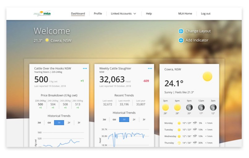 A free online dashboard that provides timely and personalised market indicators and reports, weather, industry news, and other resources to support your business.Learn more
-
Current condition
TODAY
19° 27° mostly cloudy Chance of rain: 30% Likely amount: < 1mm First
light

Last light Sunrise Sunset 5:34am EST 5:57am EST 5:41pm EST 6:04pm EST NOW23.0° Feels Like: 23.9° Relative Humidity: 80% Dew: 19.4° Wind: S 13km/h Gust: 17km/h Rainfall since 9am: 0.0mm Pressure: 1014.8hPa TODAY
 Mostly cloudy19°28°
 30%
30%
< 1mmCoolangatta Ap Now
Temperature 23.0° Feels Like 23.9° Dew Point 19.4° Rel. Humidity 80% Pressure 1014.8hPa Wind S 13km/h Wind Gusts 17km/h Rainfall 0.0mm Updated 5:20 PM24-Hour Graph
5:57am
5:34am
5:41pm
6:04pm -
Coolangatta for Friday,
CoolangattaNow23.4°cFeels Like:21.5°Wind:SE 26km/hGusts:30km/hHumidity:75% 19°Min27°MaxToday in CoolangattaCloudy. Medium chance of showers in the N, slight chance elsewhere. Light winds.Tomorrow
 19°Min28°MaxPartly cloudy. The chance of fog inland in the early morning. Slight chance of a shower. Light winds. Overnight temperatures falling to between 16 and 20 with daytime temperatures reaching the mid to high 20s.
 -
Radar

-
Radar
-
Warnings
Weather Warnings
Fri 10:47am UTC - QLDFri 10:02am UTC - QLDAustralian Government Bureau of Meteorology, Queensland
Minor Flood Warning For The Noosa River
Issued at 10:02 AM EST on Friday 04 April 2025
Flood Warning Number: 11
MINOR FLOODING POSSIBLE AT TEWANTIN ON THE HIGH TIDES
River levels remain elevated along the Noosa River at Tewantin where renewed minor flooding is possible Friday evening on the high tide.
No significant rainfall is forecast for the Noosa River catchment for the next few days.
Noosa River:
Minor flooding may occur along the Noosa River around Tewantin on the high tide.
The Noosa River at Tewantin is currently at 0.62 metres and steady, below the minor flood level.
The Noosa River at Tewantin may peak near the minor flood level (1.00 m) Friday evening, on the high tide.
Flood Safety Advice:
Remember: If it's flooded, forget it. For flood emergency assistance contact the SES on 132 500. For life threatening emergencies, call Triple Zero (000) immediately.}
Current emergency information is available at www.qld.gov.au/alerts
Next issue:
The next warning will be issued by 10:30 am EST on Saturday 05 April 2025.
Latest River Heights:
Mooloolah R at Mooloolah Alert,1.25,Falling,09:57 AM FRI 04/04/25
Mooloolah R at Mooloolah TM,1.28,Steady,09:00 AM FRI 04/04/25
Ewen Maddock Dam Alert,25.60,Steady,09:03 AM FRI 04/04/25
Ewen Maddock Dam TM,25.60,Steady,08:00 AM FRI 04/04/25
Mooloolah R U/S Parreara Weir Alert,0.20,Steady,09:56 AM FRI 04/04/25
Mountain Ck at Dixon Rd Alert,1.91,Steady,09:51 AM FRI 04/04/25
Mooloolaba Tide Alert,1.07,Rising,09:53 AM FRI 04/04/25
Mooloolaba Tide TM,1.00,Steady,09:37 AM FRI 04/04/25
Coochin Ck at Old Gympie Rd Alert,0.70,Steady,09:36 AM FRI 04/04/25
Coonowrin Ck at Glasshouse Mts Alert,1.05,Steady,09:54 AM FRI 04/04/25
Coochin Ck at Mawsons Rd Alert,0.73,Steady,08:08 AM FRI 04/04/25
Coochin Ck at Mawsons Rd TM,0.75,Steady,09:00 AM FRI 04/04/25
N Maroochy R at Eumundi Alert,0.84,Steady,09:16 AM FRI 04/04/25
N Maroochy R at Eumundi TM,0.85,Falling,09:00 AM FRI 04/04/25
Poona Dam Alert,152.58,Steady,09:22 AM FRI 04/04/25
Poona Dam TM,152.58,Steady,08:30 AM FRI 04/04/25
S Maroochy R at Kiamba Alert,1.34,Falling,09:45 AM FRI 04/04/25
S Maroochy R at Kiamba TM,1.35,Falling,09:00 AM FRI 04/04/25
Rocky Ck at Cooloolabin Dam Alert,293.12,Steady,07:23 AM FRI 04/04/25
Rocky Ck at Cooloolabin Dam TM,293.11,Steady,08:00 AM FRI 04/04/25
S Maroochy R at Wappa Dam Alert,45.00,Falling,07:35 AM FRI 04/04/25
S Maroochy R at Wappa Dam TM,45.01,Steady,08:00 AM FRI 04/04/25
S Maroochy R at Yandina Alert,1.30,Steady,09:33 AM FRI 04/04/25
S Maroochy R at Yandina TM,1.30,Falling,09:00 AM FRI 04/04/25
Maroochy R at Dunethin Rock Alert,0.26,Falling,09:44 AM FRI 04/04/25
Maroochy R at Stoney Wharf Rd Alert,0.17,Falling,09:28 AM FRI 04/04/25
Paynter Ck at Diddillibah Alert,2.26,Falling,03:28 AM FRI 04/04/25
Eudlo Ck at Eudlo Alert,1.62,Rising,09:12 AM FRI 04/04/25
Eudlo Ck at Kiels Mountain Alert,0.96,Falling,09:04 AM FRI 04/04/25
Maroochy R at Picnic Point Alert,0.11,Falling,08:04 AM FRI 04/04/25
Teewah Ck at Coops Corner TM,2.29,Steady,09:00 AM FRI 04/04/25
Teewah Ck at Coops Corner Alert,2.25,Steady,09:38 AM FRI 04/04/25
Noosa R at Tewantin Alert,0.62,Steady,07:50 AM FRI 04/04/25
Noosa R at Noosa Bar Alert,0.35,Rising,09:37 AM FRI 04/04/25
This advice is also available by dialling 1300 659 210. Warning, rainfall and river information are available at www.bom.gov.au/qld/flood. The latest weather forecast is available at www.bom.gov.au/qld/forecasts.Fri 7:26am UTC - QLDAustralian Government Bureau of Meteorology, Queensland
Final Flood Warning For The Mary River
Issued at 07:26 AM EST on Friday 04 April 2025
Flood Warning Number: 17
FLOODING NO LONGER OCCURRING AT MIVA AND TIARO
River levels have fallen and flooding has now eased across the Mary River catchment, with river levels expected to remain below minor flood levels.
A chance of showers is forecast for the remainder of Friday and into the weekend. However, rainfall totals are not expected to be significant and no further significant river level rises are expected.
Mary River downstream of Gympie:
Flooding is no longer occurring along the Mary River downstream of Gympie.
The Mary River at Miva is currently at 4.90 metres and steady, below the minor flood level (7.50 m).
The Mary River at Miva is expected to remain below the minor flood level (7.50 m).
The Mary River at Tiaro is currently at 4.84 metres and steady, below the minor flood level (6.00 m).
The Mary River at Tiaro is expected to remain below the minor flood level (6.00 m).
Mary River to Gympie:
Cancellation
Flood Safety Advice:
Remember: If it's flooded, forget it. For flood emergency assistance contact the SES on 132 500. For life threatening emergencies, call Triple Zero (000) immediately.}
Current emergency information is available at www.qld.gov.au/alerts
Next issue:
This is a final warning, no further warnings will be issued for this event.
Latest River Heights:
Obi Obi Ck at Baroon Pocket Dam Alert,0.28,Steady,06:47 AM FRI 04/04/25
Obi Obi Ck at Baroon Pocket Dam TM,217.28,Steady,05:00 AM FRI 04/04/25
Mary R at Conondale Alert,1.75,Falling,05:11 AM FRI 04/04/25
Mary R at Bellbird Creek Alert,1.40,Steady,06:52 AM FRI 04/04/25
Mary R at Bellbird Creek TM,1.41,Falling,06:00 AM FRI 04/04/25
Mary R at Kenilworth H/S Alert,0.51,Steady,05:58 AM FRI 04/04/25
Mary R at Moy Pocket Alert,2.65,Falling,05:45 AM FRI 04/04/25
Mary R at Moy Pocket TM,2.66,Steady,06:00 AM FRI 04/04/25
Yabba Ck at Borumba Dam HW Alert,-2.23,Falling,02:02 AM FRI 04/04/25
Yabba Ck at Imbil Alert,2.14,Steady,04:27 AM FRI 04/04/25
Kandanga Ck at Hygait TM,0.87,Steady,06:00 AM FRI 04/04/25
Six Mile Ck at Lake MacDonald Dam Alert,95.47,Steady,06:01 AM FRI 04/04/25
Six Mile Ck at Cooran TM,3.53,Steady,06:00 AM FRI 04/04/25
Deep Ck at Cedar Pocket Dam HW Alert,101.25,Steady,04:15 AM FRI 04/04/25
Deep Ck at Cedar Pocket Dam HW TM,101.25,Steady,05:00 AM FRI 04/04/25
Mary R at Gympie Alert,2.91,Falling,06:46 AM FRI 04/04/25
Mary R at Fisherman's Pocket TM,5.07,Falling,06:00 AM FRI 04/04/25
Wide Bay Ck at Brooyar TM,2.21,Steady,06:00 AM FRI 04/04/25
Mary R at Miva TM,4.90,Rising,06:00 AM FRI 04/04/25
Munna Ck at Marodian TM,4.21,Rising,06:25 AM FRI 04/04/25
Mary R at Home Park,5.00,Steady,06:00 AM FRI 04/04/25
Mary R at Tiaro Alert,4.84,Steady,05:32 AM FRI 04/04/25
Mary River at Owanyilla Alert,3.25,Steady,04:11 AM FRI 04/04/25
Mary R at The Barrage TM,4.41,Steady,06:00 AM FRI 04/04/25
Tinana Ck at Tagigan Rd,1.95,Steady,06:00 AM FRI 04/04/25
Tinana Ck at Bauple East TM,5.17,Falling,06:00 AM FRI 04/04/25
Tinana Ck at Tinana Barrage TM,3.57,Steady,06:00 AM FRI 04/04/25
Mary R at Portside Alert,2.20,Falling,06:48 AM FRI 04/04/25
This advice is also available by dialling 1300 659 210. Warning, rainfall and river information are available at www.bom.gov.au/qld/flood. The latest weather forecast is available at www.bom.gov.au/qld/forecasts.Fri 6:48am UTC - QLDAustralian Government Bureau of Meteorology, Queensland
Final Flood Warning For The Logan River
Issued at 06:48 AM EST on Friday 04 April 2025
Flood Warning Number: 4
FLOODING NO LONGER EXPECTED AT BEAUDESERT
Moderate rainfall totals over the last few days resulted in river level rises in the upper parts of the Logan River catchment. River levels have peaked below the minor flood level at Beaudesert during Thursday morning.
A chance of showers is forecast for the remainder of Friday and into the weekend. However rainfall totals are not expected to be significant and no further significant river level rises are expected.
Logan River to Yarrahappini:
Flooding is no longer expected along the Logan River to Yarrahappini.
The Logan River at Beaudesert peaked at 4.67 metres around 10:00 am Thursday 03 April, below the minor flood level (5.50 m). The river level is currently at 2.67 metres and falling.
The Logan River at Beaudesert is expected to remain below the minor flood level (5.50 m).
Flood Safety Advice:
Remember: If it's flooded, forget it. For flood emergency assistance contact the SES on 132 500. For life threatening emergencies, call Triple Zero (000) immediately.}
Current emergency information is available at www.qld.gov.au/alerts
Next issue:
This is a final warning, no further warnings will be issued for this event.
Latest River Heights:
Albert R at Lumeah Alert,1.30,Steady,05:54 AM FRI 04/04/25
Albert R at Lumeah TM,1.32,Rising,06:00 AM FRI 04/04/25
Albert R at Bromfleet TM,2.03,Steady,06:00 AM FRI 04/04/25
Albert R at Wolffdene Alert,2.00,Falling,05:01 AM FRI 04/04/25
Albert R at Beenleigh Alert,0.62,Falling,06:40 AM FRI 04/04/25
Burnett Ck at Maroon Dam Alert,1.28,Steady,05:47 AM FRI 04/04/25
Burnett Ck at Maroon Dam TM,208.43,Steady,05:00 AM FRI 04/04/25
Logan R at Forest Home TM,2.04,Falling,06:00 AM FRI 04/04/25
Logan R at Rathdowney Alert,3.65,Steady,05:42 AM FRI 04/04/25
Logan R at Rathdowney TM,3.66,Steady,06:00 AM FRI 04/04/25
Christmas Ck at Tramway Lane TM,1.74,Rising,06:00 AM FRI 04/04/25
Logan R at Round Mountain Alert,4.60,Falling,05:35 AM FRI 04/04/25
Logan R at Round Mountain TM,4.60,Falling,06:00 AM FRI 04/04/25
Logan R at Beaudesert Alert,2.67,Falling,05:14 AM FRI 04/04/25
Teviot Bk at Boonah Alert,3.30,Falling,05:20 AM FRI 04/04/25
Teviot Bk at Wyaralong Dam TM,64.03,Steady,05:00 AM FRI 04/04/25
Teviot Bk at Wyaralong Dam Alert,0.42,Steady,06:47 AM FRI 04/04/25
Logan R at Yarrahappini Alert,7.74,Falling,05:57 AM FRI 04/04/25
Logan R at Yarrahappini TM,7.75,Falling,06:00 AM FRI 04/04/25
Logan R at Maclean Br Alert,7.14,Falling,06:15 AM FRI 04/04/25
Logan R at Logan Village Alert,4.76,Rising,06:14 AM FRI 04/04/25
Logan R at Waterford Alert,2.35,Falling,06:42 AM FRI 04/04/25
Slacks Ck at Loganlea Rd Alert,2.05,Steady,06:07 AM FRI 04/04/25
Logan River at Parklands Alert,0.89,Falling,06:39 AM FRI 04/04/25
This advice is also available by dialling 1300 659 210. Warning, rainfall and river information are available at www.bom.gov.au/qld/flood. The latest weather forecast is available at www.bom.gov.au/qld/forecasts. -
48-Hour Weather Forecast
Next 48 Hours
-
7 day forecast
Today: Cloudy. Medium chance of showers in the N, slight chance elsewhere. Light winds.
Forecast for Coolangatta (28.1681°S, 153.5353°E, 8m AMSL) Friday
Apr 4Saturday
Apr 5Sunday
Apr 6Monday
Apr 7Tuesday
Apr 8Wednesday
Apr 9Thursday
Apr 1019° 27° 19° 28° 19° 27° 18° 29° 18° 27° 17° 26° 17° 27° 


Mostly cloudy Mostly sunny Possible shower Mostly sunny Possible shower Showers Showers Rain Chance 30% 50% 40% 60% 60% 90% 80% Rain Amount < 1mm 1-5mm < 1mm 1-5mm 1-5mm 1-5mm 1-5mm UV index Very High Very High Very High High High High Very High Fire Danger Rating No Rating No Rating No Rating No Rating No Rating - - Frost risk Nil Nil Nil Nil Nil Nil Nil 9am 3pm 9am 3pm 9am 3pm 9am 3pm 9am 3pm 9am 3pm 9am 3pm 20
(km/h)20
(km/h)10
(km/h)14
(km/h)16
(km/h)13
(km/h)11
(km/h)15
(km/h)14
(km/h)21
(km/h)20
(km/h)21
(km/h)20
(km/h)23
(km/h)Wind S SSE SW ESE S ESE NW ENE S SSE S SSE S SSE Humidity 84% 73% 71% 67% 70% 61% 67% 58% 71% 65% 76% 75% 77% 76% Dew point 19°C 20°C 19°C 20°C 18°C 17°C 18°C 18°C 19°C 18°C 19°C 19°C 20°C 21°C First light 5:34am 5:34am 5:35am 5:35am 5:36am 5:36am 5:37am Sunrise 5:57am 5:58am 5:58am 5:59am 5:59am 6:00am 6:00am Sunset 5:41pm 5:40pm 5:39pm 5:38pm 5:36pm 5:35pm 5:34pm Last light 6:04pm 6:03pm 6:02pm 6:01pm 6:00pm 5:59pm 5:58pm -
Popup - Daily historical
-
-
Popup - Monthly historical
 Sign in to myMLA for deeper weather insights.28 Day and 12 Month Rainfall forecast
Detailed Historical Observations and Climatology
