Australian Government Bureau of Meteorology
New South Wales
Warning to Sheep Graziers
for Snowy Mountains and Australian Capital Territory forecast districts
Issued at 11:07 AM EST on Sunday 06 April 2025
Warning to Sheep Graziers for the following areas:
Snowy Mountains and Australian Capital Territory forecast districts
Sheep graziers are warned that cold temperatures, showers and westerly winds are expected during Sunday and Monday. Areas likely to be affected include parts of the Snowy Mountains and Australian Capital Territory forecast districts. There is a risk of losses of lambs and sheep exposed to these conditions.
Cancellation of Warning to Sheep Graziers for the following areas:
Illawarra, Central Tablelands, Southern Tablelands and South West Slopes forecast districts
The Warning to Sheep Graziers for the Illawarra, Central Tablelands, Southern Tablelands and South West Slopes forecast districts has been cancelled.
The next warning will be issued by 5:00 pm EST Sunday.
Forecast
Mullion (35.1287°S, 148.8717°E, 562m AMSL) set as my default location ›
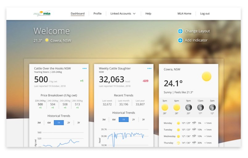
myMLA

 A free online dashboard that provides timely and personalised market indicators and reports, weather, industry news, and other resources to support your business.Learn more
-
Current condition
TODAY5° 21° cloud increasing Chance of rain: 5% Likely amount: < 1mm First
light

Last light Sunrise Sunset 5:55am EST 6:20am EST 5:53pm EST 6:19pm EST NOW16.2° Feels Like: 14.0° Relative Humidity: 30% Dew: -1.1° Wind: NW 0km/h Gust: 0km/h Rainfall since 9am: 0.0mm Pressure: 1017.7hPa TODAY
Cloud increasing7°22° 5%
5%
< 1mmMULLION Now
Temperature 16.2° Feels Like 14.0° Dew Point -1.1° Rel. Humidity 30% Pressure 1017.7hPa Wind NW 0km/h Wind Gusts 0km/h Rainfall 0.0mm Updated 1:50 PM24-Hour Graph
6:20am
5:55am
5:53pm
6:19pm -
Mullion for Sunday,
MullionNow19.4°cFeels Like:12.8°Wind:NW 24km/hGusts:37km/hHumidity:28%5°Min21°MaxToday in MullionMostly sunny, becoming partly cloudy in the afternoon. Patchy fog in the SE early this morning. Slight chance of a shower in the SE, near zero chance elsewhere. Winds NW 20 to 30 km/h turning W 25 to 40 km/h during the morning. Daytime maximum temperatures between 18 and 21.Tomorrow7°Min22°MaxSunny. Winds W 25 to 40 km/h becoming light in the evening. Overnight temperatures falling to between 5 and 9 with daytime temperatures reaching between 19 and 22. -
Radar

-
Radar
-
Warnings
Weather Warnings
Sun 11:07am UTC - NSW -
7 day forecast
Today: Mostly sunny, becoming partly cloudy in the afternoon. Patchy fog in the SE early this morning. Slight chance of a shower in the SE, near zero chance elsewhere. Winds NW 20 to 30 km/h turning W 25 to 40 km/h during the morning. Daytime maximum temperatures between 18 and 21.
Forecast for Mullion (35.1287°S, 148.8717°E, 562m AMSL) Sunday
Apr 6Monday
Apr 7Tuesday
Apr 8Wednesday
Apr 9Thursday
Apr 10Friday
Apr 11Saturday
Apr 125° 21° 7° 22° 4° 24° 9° 26° 9° 26° 10° 29° 10° 28° Cloud increasing Sunny Mostly sunny Fog then sunny Mostly sunny Mostly sunny Mostly sunny Rain Chance 5% 5% 5% 10% 5% 5% 5% Rain Amount < 1mm < 1mm < 1mm < 1mm < 1mm < 1mm < 1mm UV index High High High High High High High Fire Danger Rating Moderate Moderate Moderate Moderate - - - Frost risk Slight Nil Slight Nil Nil Nil Nil 9am 3pm 9am 3pm 9am 3pm 9am 3pm 9am 3pm 9am 3pm 9am 3pm 18
(km/h)24
(km/h)18
(km/h)23
(km/h)6
(km/h)5
(km/h)7
(km/h)7
(km/h)5
(km/h)8
(km/h)3
(km/h)7
(km/h)11
(km/h)11
(km/h)Wind WNW W WNW W E NNW E NW E NW S SSW ESE ESE Humidity 42% 30% 59% 38% 68% 36% 73% 35% 70% 35% 62% 30% 66% 37% Dew point 1°C 3°C 7°C 7°C 8°C 8°C 12°C 10°C 12°C 10°C 11°C 10°C 12°C 12°C First light 5:55am 5:56am 5:57am 5:57am 5:58am 5:59am 6:00am Sunrise 6:20am 6:21am 6:22am 6:23am 6:23am 6:24am 6:25am Sunset 5:53pm 5:52pm 5:51pm 5:49pm 5:48pm 5:47pm 5:45pm Last light 6:19pm 6:17pm 6:16pm 6:15pm 6:13pm 6:12pm 6:11pm -
Popup - Daily historical
Mullion Observations History
We're sorry, but there are no daily observations available for Mullion
-
-
Popup - Monthly historical
 Sign in to myMLA for deeper weather insights.28 Day and 12 Month Rainfall forecast
Detailed Historical Observations and Climatology


